Forging a Bright and Sustainable Future Together. ![]()
Our Projects
Engineering Sustainable Solutions Across Industries.
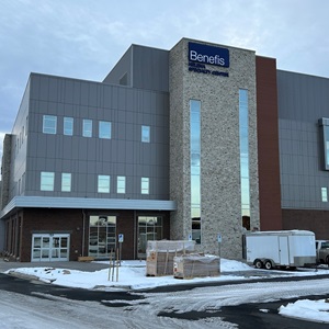
Benefits Health Systems Outpatient and Surgery Center
Helena, Montana
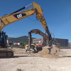
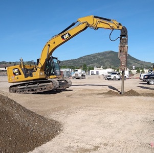
Pioneer recently concluded a comprehensive geotechnical drilling investigation and performed the foundation design for a new 4-story structural steel building, poised at the former mall location in Helena. The project faced a challenge as the team unearthed uncontrolled fill material, a remnant from the demolished mall structure. Further complicating the site conditions, laboratory analysis of consolidation tests indicated that the subgrade soil was prone to significant collapse when saturated. To address these challenges, Pioneer's design incorporated the use of rammed aggregate piers. This innovative technique was instrumental in stabilizing both the uncontrolled fill and the native subgrade soil, significantly mitigating the risk of settlement. In addition to the design phase, Pioneer meticulously oversaw the on-site quality assurance during the installation of the rammed aggregate piers, ensuring the intent of the design was met.
Prickly Pear Creek Realignment Project
East Helena, Montana
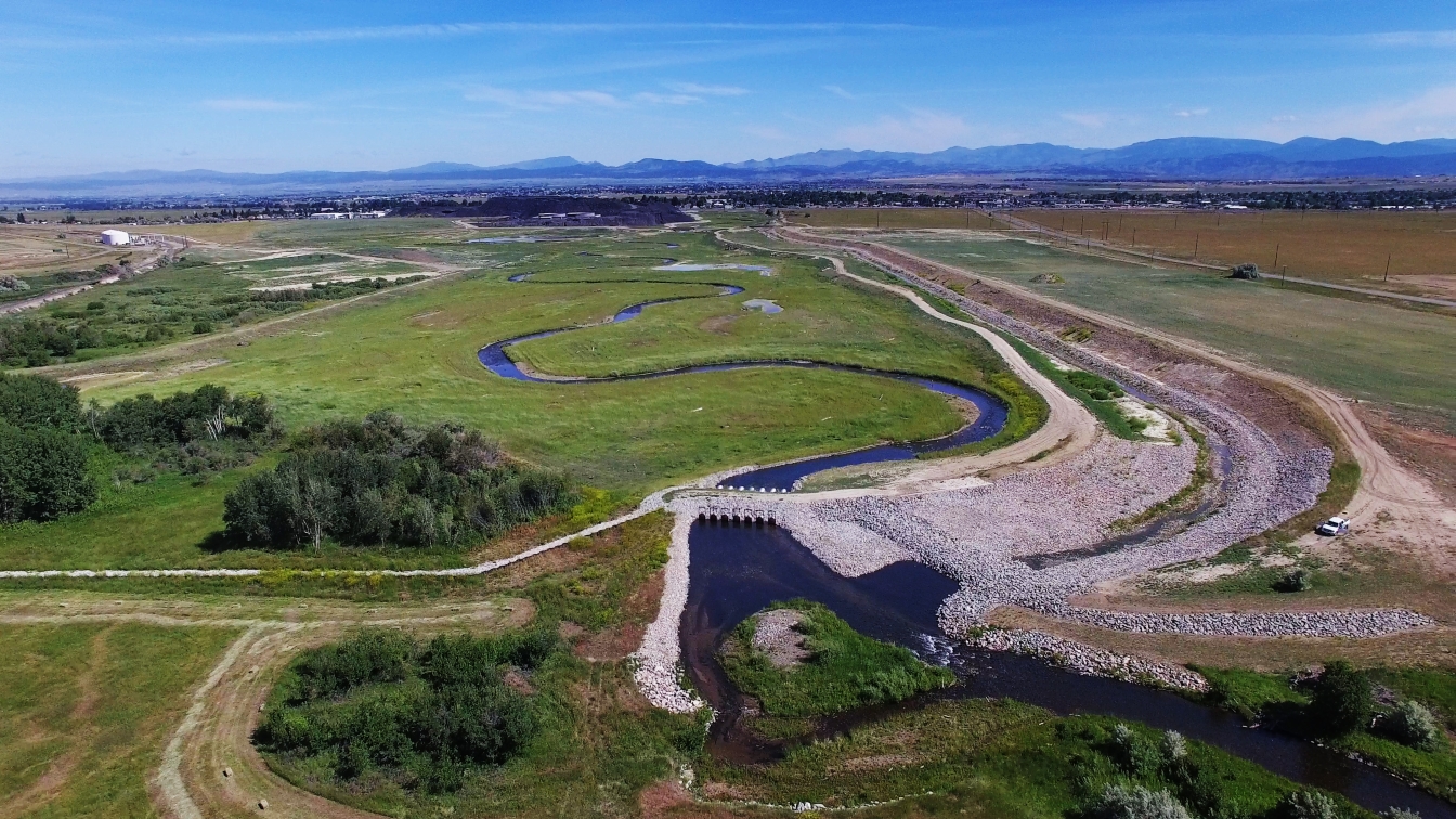
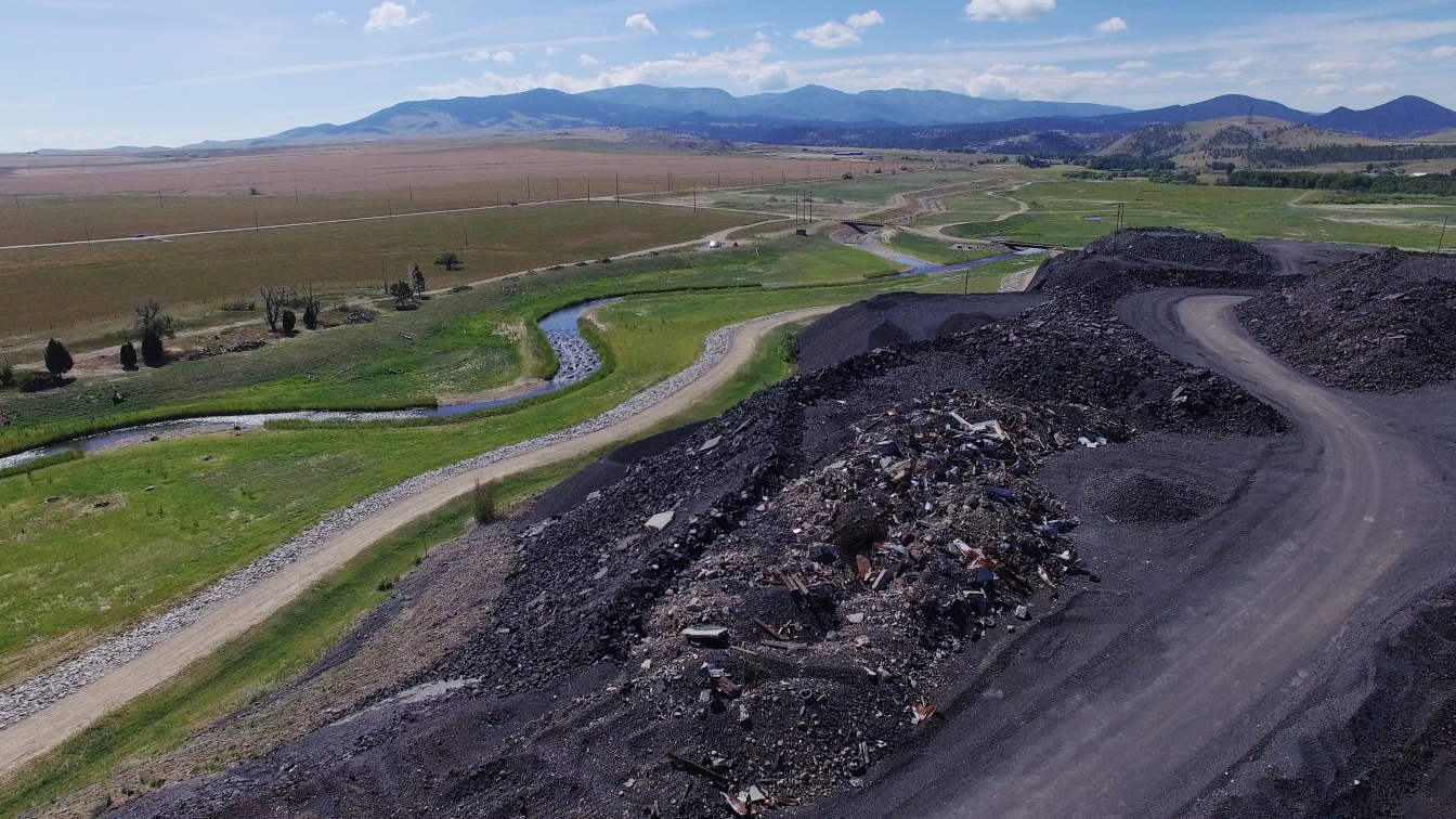
Near Helena, Montana, Pickly Pear Creek was contaminated after a century's worth of smelter activities deposited arsenic, lead, and other containments into its soil and groundwater. A 5-year cleanup solution included lowering the groundwater and restoring the creek to its natural channel. This included moving over a million cubic yards of materials.
FIDIC - 2019 International Merit Award
ACEC - 2019 Grand National and Montana Engineering Excellence Awards.
Montana Contractors Association - Special Recognition Excellence Awards for Water Quality and Habitat Restoration.
Since 2011, Pioneer has provided a full range of planning, data collection, environmental permitting, remedial design, project management, construction management, and monitoring services at the East Helena Smelter Resource Conservation and Recovery Act Site to support corrective measures implemented to remediate contaminated soil and groundwater at the site. The project removed a derelict dam and impacted reservoir sediments and then relocated approximately 1.25 miles of Prickly Pear Creek and its floodplain to the eastern margin of the site. These actions permanently lowered groundwater beneath the entire site and reduced groundwater flux through inaccessible contaminated soils which reduced contributions to the contaminated groundwater plume without long-term pumping.
Pioneer completed the following major activities:
1. Collected baseline stream, wetland, and soils data to support, permitting and design.
2. The creek relocation project disturbed approximately 45 acres of jurisdictional wetlands and over a mile of
existing stream channel. Pioneer led the complicated permitting effort that
included multiple joint applications, letter and conditional letter of map revision elements, floodplain permits, and
a full range of other environmental permits.
3. Designed the stream channel and floodplain to replace all wetland losses with functions and values (FEWA) that
meet or exceed the pre-project conditions.
4. Designed the stream and floodplain to provide the desired hydraulic controls for the site ground water remedy
and to deliver materials for the final plant site cap.
5. Finalized the design and mitigation plans, obtained all permits, solicited, awarded, managed and completed the
construction contract.
6. Construction was completed in July 2017 and Pioneer is currently performing monitoring and maintenance
activities at the site.
CLIENT:
Montana Environmental Trust Group, LLC (METG)
LOCATION:
East Helena, MT
TIME:
2011 to Present
KEY PERSONNEL:
Joel Gerhart, P.E.
George Austiguy, P.E.
Murray Strong
Tony Wesche, P.E.
CONTRACT AMOUNT:
$2.3 Million- Planning and Design
$11 Million - Construction
SERVICES:
Stream Assessment
Wetlands Delineation
Wetland Mitigation Design
Wetland, Stream, and Environmental Permitting
Stream Channel, Floodplain/ Wetland Design
Project Coordination
Construction Contracting Management/Oversight
CONTACT:
Ms. Cynthia Brooks, Trustee, President, METG, GETG 11 Flagg Street
Unit 1
Cambridge, MA 02138 617 448-9762
cb@g-etg.com
Powell Countywide Modernization Project
Powell County, Montana
Scope of Work:
As part of the Powell County Modernization project, Pioneer performed detailed survey, structure inventory, and site visits on the Clark Fork, Blackfoot, and Little Blackfoot Rivers and their tributaries. This work included hydraulic structure survey of 105 hydraulic structures, bathymetric channel cross
section survey at 182 channel locations and survey of reference marks at 8
United States Geological Survey (USGS) gaging stations. Structure Inventories of 74 stream spanning structures were performed. A total of 66 site visits were performed. All survey tasks and data acquisition were performed in accordance with FEMA and DNRC guidance standards.
Project Performance:
Results of the survey tasks were compiled into a report and submitted to DNRC and FEMA. The project was completed on schedule and within the original budget.
Knowledge Enhancement & Lessons Learned:
In the Global Positioning System (GPS) structure survey work early stages, field data was uploaded daily for engineering QA/QC and to expedite the development of structure drawings in AutoCAD. The QA/QC team members realized that field crews were collecting more survey points than needed to define the required bridge and culvert elements for modeling. These additional points were slowing both QA/QC and drafting efforts. In response, Pioneer developed a more concise and standardized list of required survey points and relayed the information to the survey field team. This updated method was used for the remainder of the GPS survey data acquisition and increased the efficiency of the survey field team, the QA/QC process, and the hydraulic engineering team.
CLIENT:
Montana Department of Natural Resources and Conservation
LOCATION:
Powell County, MT
TIME:
2011 to Present
KEY PERSONNEL:
Mark Meyer
George Austiguy, P.E.
Jon Jupka
David Wilson
Jacob Ulgenes
Mason Bowditch
Danny Reiss
Remy Georgeton
Jared Cooper
CONTRACT AMOUNT:
$489,900
SERVICES:
Land Survey
Structure Survey
Bathymetric Survey
CONTACT:
Steve Story, Chief Water Operations Bureau
1424 9th Avenue
Helena, Montana
59620-1601
406-444-6816
sestory@mt.gov
Upper Harshaw Creek Mines Environmental Remediation
Santa Cruz County, Arizona
The Coronado National Forest is a United States National Forest that includes an area of about 1.78 million acres spread throughout mountain ranges in southeastern Arizona and southwestern New Mexico. Under CERCLA, officials developed an environmental cleanup plan for the abandoned Harshaw Creek Mines Sites within the forest.
With a redesign required of the Marstellar Consolidation Cell to accommodate more waste, the Pioneer Team worked closely with the Forest Service to develop alternate plans and implement the preferred alternative. At the Endless Chain Waste Rock site, more waste was consolidated in place than planned and the site was redesigned to accommodate the change.
To remediate the Upper Harshaw Creek Mines in the Coronado National Forest, Santa Cruz County, Arizona, the Pioneer Team implemented a Forest Service design to reclaim historic mine waste at these sites. Remediation work involved:
· Construction of three separate, on-site consolidation cells for disposal of waste.
· Removal of over 78,000 cubic yards of contaminated waste rock and tailings from five abandoned mines: the Marstellar, Augusta, Blue Nose, Endless Chain, and Morning Glory Mine sites.
· Collection of confirmation samples from waste rock removal areas and use of field-portable X-Ray Fluorescence testing to ensure that cleanup levels for arsenic and lead were achieved at each location.
· Cover material placing over the consolidation cells.
· Road building, reclamation, channel construction, adit and shaft closure work.
Oversight work required before and after surveys to calculate waste volumes and provide as-built drawings. Density testing was conducted within the consolidation cells to verify proper compaction.
Due to unforeseen conditions, the Pioneer team had to employ an adaptive approach to accommodate rock excavation in the consolidation cells and significant increases in waste volumes (over 56%). By working closely with the Forest Service we were able to overcome these challenges and complete all work within the required project timeline.
Work was completed at the Marstellar, Augusta, and Blue Nose sites in early March 2021. Construction on the Endless Chain and Morning Glory sites was completed in December 2021.
CLIENT:
USDA Forest Service
LOCATION:
Coronado National Forest
Santa Cruz County, Arizona
TIME:
2020 to 2021
KEY PERSONNEL:
Tim Ranf, P.E.
Marty Bennett
Cedar Richards
Weston Solutions, Inc. (Construction Oversight)
Overley's, Inc. (Construction work)
CONTRACT AMOUNT:
$2,760,888
SERVICES:
Environmental Remediation
Construction Oversight
Engineering Oversight
Construction
Surveying
CONTACT:
Maria McGaha
USDA Forest Service
333 Broadway SE
Albuquerque, NM 87102
505-842-3837
maria.mcgaha@usda.gov

